How the Bosphorus Shaped the Destiny of Istanbul
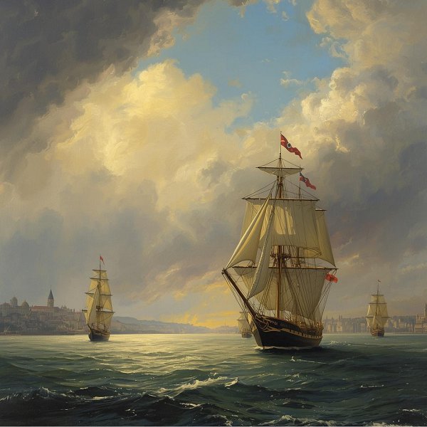
Straddling the boundary between two continents, the Istanbul Bosphorus is far more than a simple strait. It is a restless, serpentine waterway that has, for millennia, functioned as both a formidable natural barrier and a vital artery of connection. To the observer, it appears as a sinuous, coiling snake, its body twisting for approximately 18 nautical miles as it connects the Black Sea to the Sea of Marmara. But beneath this deceptively elegant surface lies a complex geological history and a unique set of maritime conditions that have collectively forged the character, the wealth, and the tumultuous destiny of the great city that bears its name. The Bosphorus is not merely a geographical feature of Istanbul; it is the very reason for its existence, the source of its power, and the enduring stage upon which its history has unfolded. The story of this iconic strait begins not with water, but with land. Millions of years ago, during the late Tertiary period, the landscape was dramatically different. The Black Sea was then an isolated, vast freshwater lake, while the Sea of Marmara was a much smaller, unremarkable body of water. The profound transformation began as the Earth’s climate warmed at the end of the last Ice Age, causing massive glaciers to melt. A colossal surge of water from the rising Mediterranean and Aegean seas pushed through what would become the Dardanelles, then forced its way through a narrow, ancient river valley that connected the Marmara to the Black Sea. This was no gentle confluence; it was a cataclysmic event. The force of the Mediterranean waters carving through the land created the Bosphorus, and the sudden, violent influx rapidly expanded the small Marmara basin into the sea we know today. This dramatic birth is the foundation upon which all else is built, for it gifted the strait with its most singular characteristic: a powerful, two-tiered current system. This dual-layered flow is a hydrological marvel born from the geological event that created it. The surface current is a relatively fast-moving stream of less saline, cooler water rushing southwards from the Black Sea towards the Marmara and, eventually, the Mediterranean. However, flowing in the opposite direction, deep beneath the surface, is a denser, saltier, and warmer current originating from the Mediterranean, pushing its way northwards through the strait and into the Black Sea. This invisible, underwater river is the ghost of the ancient Mediterranean flood that birthed the Bosphorus, a perpetual memory of its own creation. For ancient mariners, this dichotomy was both a formidable challenge and a secret to be mastered. In antiquity, navigating this serpentine corridor was a test of supreme seamanship. The prevailing winds were unreliable, and the powerful surface current could easily overwhelm a ship powered only by oars and sail, particularly a heavily laden trading vessel. Sailors of the ancient world, from the Greeks to the Romans, possessed a profound understanding of the sea’s hidden dynamics. To traverse the Bosphorus, they did not merely rely on the wind. They developed a technique born of observation and necessity: they would lower weighted lines, or even anchor-like devices, deep into the water to gauge the strength and direction of the lower current. By positioning their ships in the specific layer where the opposing flows created a zone of relative calm, or by using the deep current to pull against the surface flow, they could achieve steerage and make headway against the dominant southern rush. It was a delicate and dangerous art, a form of underwater sailing that required intimate knowledge of the strait’s every bend and submerged topography. When the winds were uncooperative or the currents too treacherous, the ancient seafarers needed refuge. Their salvation lay in a natural harbor of exceptional quality: the Golden Horn. This horn-shaped estuary, a deep, sheltered inlet that flows into the Bosphorus on the European side, was not just a safe anchorage; it was a near-perfect natural harbor. Shielded from the strait’s capricious currents and the fierce storms that could blow in from the Black Sea, it offered a haven of calm water. Here, vessels could wait for days or weeks for favorable conditions to continue their journey. This confluence of a challenging but navigable international strait and a perfectly situated safe harbor created an unparalleled maritime hub. It was a place where ships—and the goods, people, and ideas they carried—were compelled to stop, to wait, and in doing so, to trade. This maritime imperative was the engine that drove the city’s immense wealth. From its origins as the modest trading post of Byzantium, the city grew rich by controlling this choke point. Every ship passing between the Mediterranean and the Black Sea, carrying grain from Egypt, furs and slaves from the Russian steppes, or precious metals and timber from the Caucasus, had to pass through the Bosphorus. The tolls levied, the services provided, and the market that naturally formed on the shores of the Golden Horn generated a level of prosperity that was the envy of the ancient world. It was this strategic and economic supremacy that caught the eye of the Roman Emperor Constantine the Great in the early 4th century AD. Surveying a crumbling Roman Empire, with its western frontiers under constant threat, Constantine sought a new capital—a city that was defensible, strategically located, and blessed with immense commercial potential. He found it on the shores of the Bosphorus. In 330 AD, he formally dedicated the city as Nova Roma, though it would soon bear his name: Constantinople. The emperor understood that the city’s wealth was not built on its own hinterland, but on its mastery of the sea lanes. The Bosphorus, with its Golden Horn harbor, was the key to an empire. By relocating the capital’s center of gravity to this point, Constantine transformed a regional trading post into the heart of the Roman—and later Byzantine—world, a city that would remain the wealthiest and most magnificent in Christendom for over a millennium. Yet, as the proverb warns, “where there is great wealth, there are also many to take it.” The very riches that made Constantinople the “Queen of Cities” became a perpetual magnet for conquest. The city’s history is a saga of countless sieges, a testament to its allure and its resilience. The list of peoples who sought to claim its wealth reads like a roll call of empires and warrior cultures. In the 9th and 10th centuries, the fierce Viking traders and raiders known as the Rus’ (the ancestors of Russians, Ukrainians, and Belarusians) descended upon the city, launching several naval expeditions from the Black Sea. They sought to break the Byzantine monopoly on trade and plunder its legendary riches. From the north, the Bulgarians, a powerful empire on the city’s doorstep, repeatedly besieged Constantinople, seeking to either capture it or extort massive tribute. The Arabs, in the 7th and 8th centuries, launched massive land and sea campaigns against the city, their fleets filled with the ambition to conquer the capital of Christendom for the new faith of Islam. Their famous sieges, which lasted for years, tested the city’s Theodosian Walls to their limits but ultimately failed, thanks in no small part to the city’s command of the sea and the invention of Greek fire—a terrifying, liquid incendiary weapon that allowed Byzantine ships to incinerate enemy fleets in the Bosphorus. And then, of course, there were the Turks. For centuries, various Turkic beyliks and the rising Ottoman Sultanate viewed the city as the ultimate prize—the “Red Apple,” a symbol of world dominion. The Ottomans began their efforts in earnest in the late 14th century, but it was Sultan Mehmed II, “the Conqueror,” who finally achieved what so many before him could not. In 1453, he orchestrated a siege of unprecedented scale and ingenuity. He built the fortress of Rumeli Hisarı on the European shore of the Bosphorus, directly across from the existing Anadolu Hisarı on the Asian side, giving him complete control over the strait and the ability to bombard any ships attempting to resupply the city. In a legendary feat of military engineering, he even hauled his navy overland on greased logs, bypassing the great chain the Byzantines had stretched across the Golden Horn to protect their harbor. On May 29, 1453, the city fell, marking the end of the Byzantine Empire and the dawn of a new era. The Bosphorus, however, did not lose its significance with the change of empire. For the Ottomans, it was the heart of their new capital, Istanbul. The sultans built magnificent palaces, like the Topkapı and later the Dolmabahçe, along its shores, literally placing their seat of power at the center of this watery crossroads. The strait remained the economic lifeline of the empire, controlling trade and connecting the vast Ottoman lands in Europe, Asia, and Africa. The beautiful waterfront mansions, the yalıs, that still line its shores today are a testament to the wealth and prestige that the Bosphorus continued to generate. In conclusion, the Istanbul Bosphorus is far more than an 18-nautical-mile waterway separating Europe and Asia. It is a living entity, a geological artifact of a primordial flood, and a hydrological enigma with its two-faced currents. This unique nature made it a crucible for ancient maritime skill, a source of immense wealth, and the strategic core of two great empires. From the Greek sailors who learned to dance with its currents to the Roman emperor who staked his empire’s future on its shores, from the countless armies that sought to conquer its riches to the Ottomans who made it the center of their world, the Bosphorus has been the ultimate arbiter of Istanbul’s fate. Its serpentine form is not just a natural feature; it is the physical embodiment of the city’s own history—twisting, turning, and navigating a course between worlds, forever defined by the powerful and beautiful waters that flow through its soul.
Last Modification : 4/18/2026 7:17:20 AM